Jul 22, 2024
Introducing Our Latest Feature Update: Field Region Reports, Now by Application Rate
Let’s take a look at what’s new with Field Region Reports, and how you can take advantage of the latest updates.
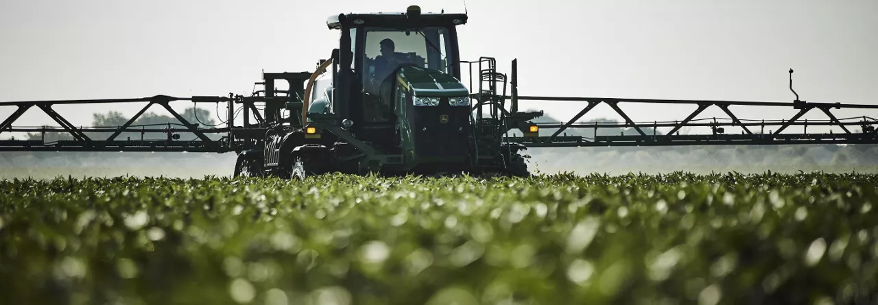
FieldView's platform partner, Drone Deploy, gives you cutting-edge software gives you a deeper understanding of your fields, and can help you make more efficient, informed decisions—all from the edge of your field.
On its own, Climate FieldView™ is a powerful tool that can help you make data-driven decisions to get the most out of every acre. But by taking advantage of the different partnerships available, you get a superpowered experience. One of those platform partnerships is DroneDeploy, a reality-capture drone software platform that when used with FieldView™, can have huge implications for your in-field efforts. This cutting-edge software works to give you a deeper understanding of your fields and can help you make more efficient, informed decisions—all from the edge of your field.
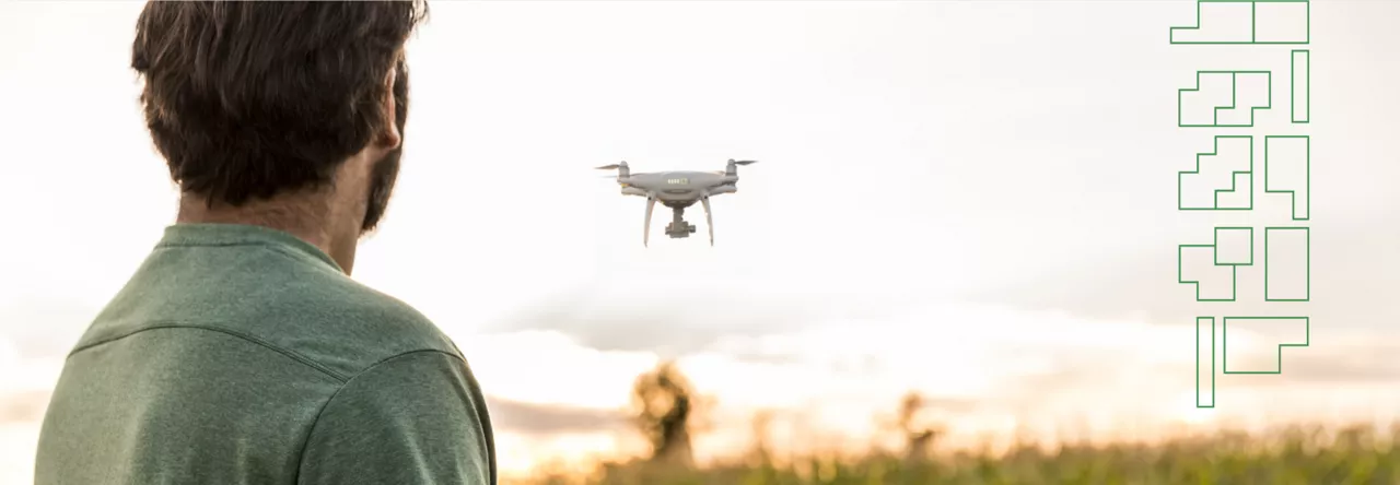
Using DroneDeploy together with FieldView can help you level up your operation with faster crop scouting, easier stand counts, and field maps that build in just 15 minutes.
DroneDeploy's stand count copabilities currently support corn and soy.
One of DroneDeploy’s “field edge” solutions for FieldView users is the ability to perform a stand count, specifically for corn and soy. Where a manual stand count could take hours or even days to complete, this autonomous drone mission takes only 15 minutes of flight time to cover 100 acres of crops. Simply import your field boundaries from FieldView, and DroneDeploy will create a drone flight plan to take care of the rest, no flight experience required.
As the drone is flying, machine learning runs right there on the field’s edge and provides you with instant results after the drone lands. Not only are you able to save 90% of the time and cost it would typically take you to gather this data, you’ll also receive more accurate data; your sampling points will cover the entire field, showing you exactly where the problem areas are every time. From there, you can create and share stand count reports with your partners and growers, so you can make replant and other early-season decisions faster. New in 2024, DroneDeploy can conduct automated stand counts as early as VE (emergence) growth stage.
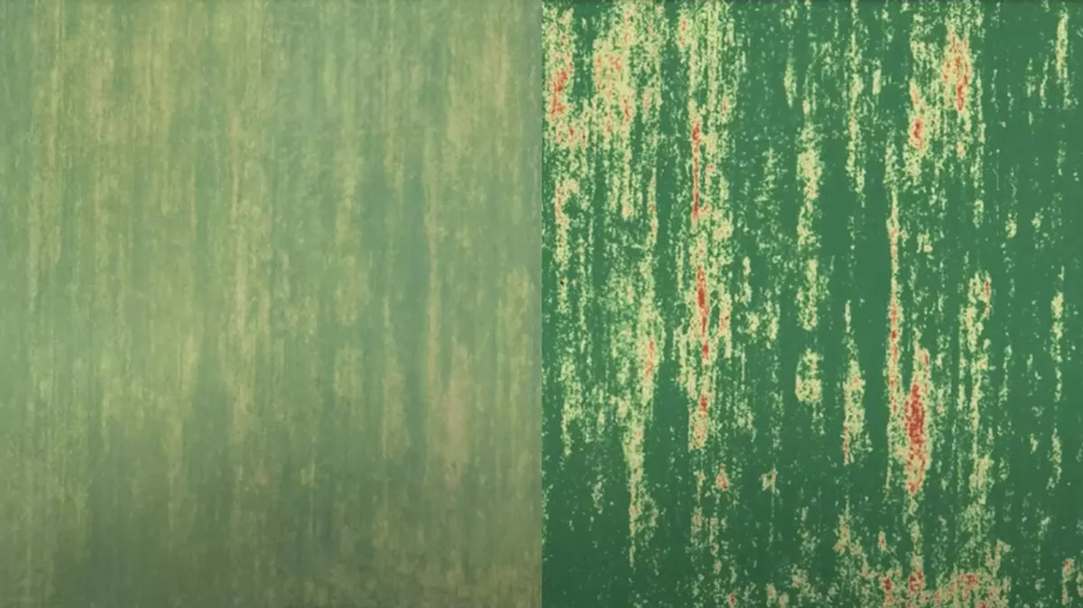
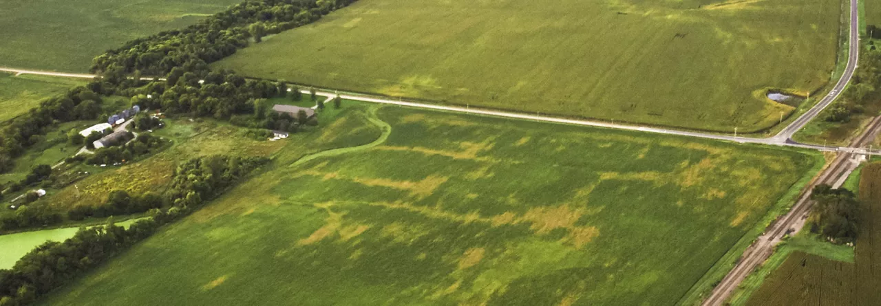
Left: Image from a field flight after VARI is applied, highlighting problem areas quickly and clearly.
Right: Unedited image from a field flight, before VARI is applied.
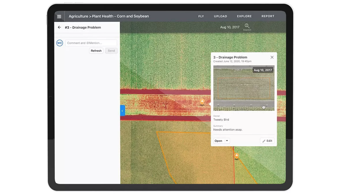
FieldView users are no strangers to mapping their fields. With DroneDeploy’s Live Map tool, your field maps provide the foundation for easier, faster crop scouting. With just a 15-minute flight—planned automatically based on your field boundaries imported from FieldView—you can build out a real-time crop health map to identify problem areas. Using a function called the Visible Atmospherically Resistant Index, or VARI, DroneDeploy measures the color of each pixel to better highlight areas that may need attention. And there’s no need for fancy, overpriced equipment—with DroneDeploy, you can use a normal RGB camera drone. From there, you can use a built-in toolset within DroneDeploy to make adjustments, create zones, drop pins, and export everything back into the FieldView app to view as layers.
If the standard soil sample is listening to a song on the radio, then soil biology is a live concert in your living room.
Using the plant health tools in DroneDeploy, you can easily map a flight before and after product application to compare plant health side-by-side and get immediate results. Instead of waiting for “lessons learned” at the end of the season, you can understand what’s happening in every field as the season progresses, and make decisions in the moment.
When it comes to boots-in-the-dirt field work, using DroneDeploy in conjunction with FieldView is your ticket to saving time and working more efficiently. By using both tools synergistically throughout the season, you can create a more holistic workflow that will help you collaborate with your partners better and make the best decisions for every field, all year long.
Our Friend of FieldView webinar is a great resource if you’d like to learn more about the ins and outs of using DroneDeploy and FieldView together. You can also visit our website to request a demo and see some real-world examples of how this technology can help enhance your FieldView experience. Happy flying!

Let’s take a look at what’s new with Field Region Reports, and how you can take advantage of the latest updates.
Let’s dive deeper into Combyne and learn more about how it works together with FieldView™ to help growers with the revenue side of running a farm.
FieldView makes it easy to spot inconsistencies in the field; it’s just a matter of telling the difference between dark green and light green.